We all scratch our heads from time to time about time-zones. As well as the logistical and administrative complexities they create, the choices some countries make about their time seem strange. Such as China’s decision to have a single zone for a country that spans over 60° (four hours) of longitude - 2° more than the contiguous US States which span four time zones. In Tibet solar time is more than two hours behind official time, leading to a tension between Beijing time and semi-official Xinjiang time. We might ask which other parts of the world have unusual relationships with their official time.
To answer this is straightforward: time-zones are mapped to solar time via Greenwich Meantime, which is itself – interestingly – set not by the sun as you might expect (too close, big and bright for accurate readings) but by the positions of distant quasar stars in the sky. Local solar time can be calculated for anywhere by adding local longitude/15 to current GMT. If you subtract that from the official time you get an idea of how far ahead or behind official time you really are. Here’s how it looks.
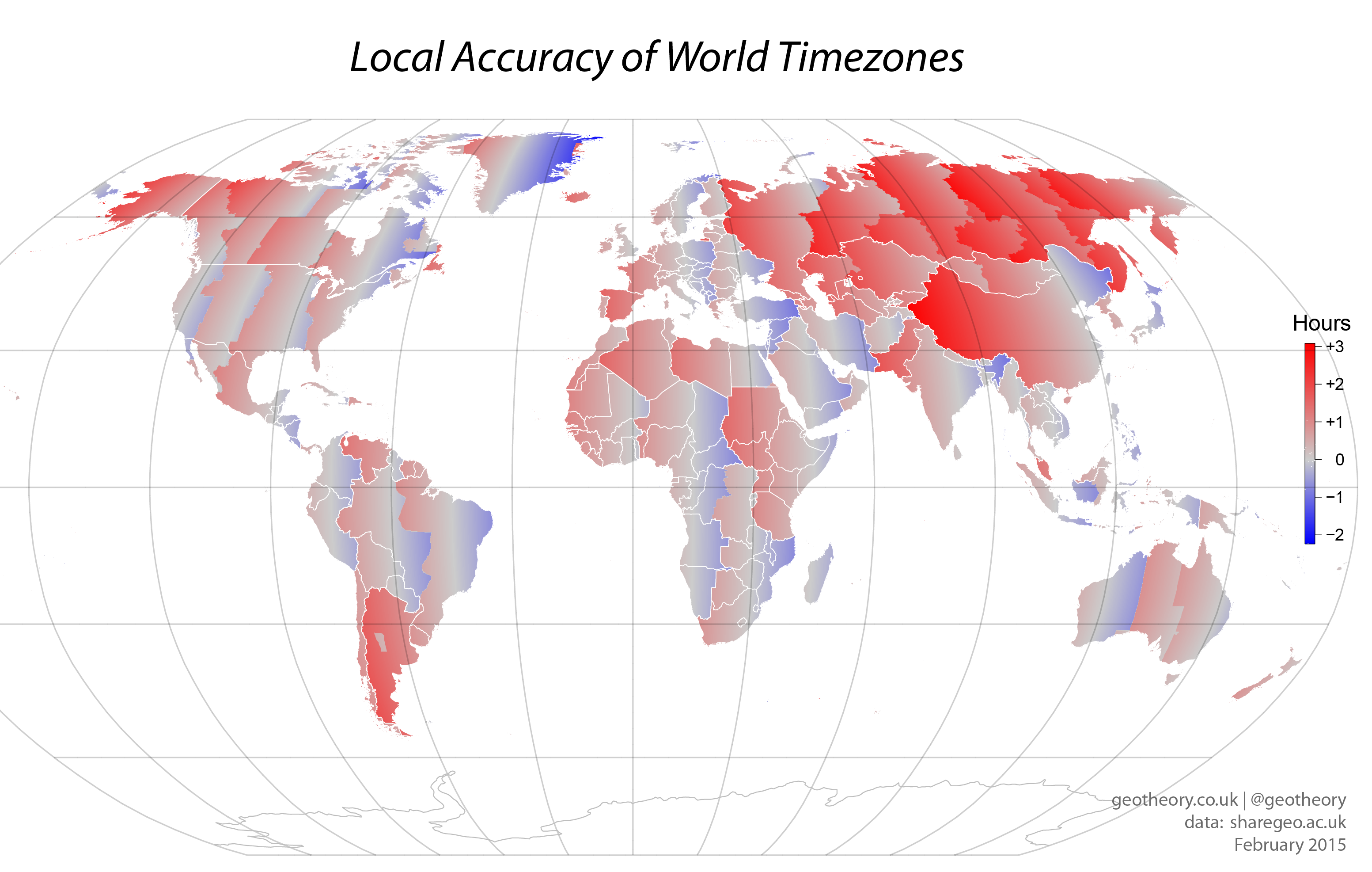
What’s the story with Russia you ask? Well it seems Mr Putin decided the country should move permanently to Daylight Saving Time (DST), hence the heartlands red colour. With many Russians objecting to the sun peaking before 10/11am it’s been an unpopular policy – so unpopular in fact that it’s now being repealed after just 3 years. The questionable nature of China’s policy is illustrated by an attractive from deep red-to-blue gradient. Argentina’s time is highly offset, with the number of policy changes over the years suggesting it’s a politically charged question.
A couple of other interesting factoids emerged that aren’t visible. Firstly that the most offset time-zone in the world is set to GMT +14h, occupied by the Line Islands, of which Kiritimati (157.4° W) is the furthest ‘East’. This puts it on the same time (yesterday) as Hawaii (GMT -10h), the Western most point of is Attu Island (172° E), making these the 2 islands responsible for much of the International Date Line’s peculiar route. Secondly, the Russian/American residents of the two Diomede Islands in the Bering Strait – presumably military and spies – are on GMT +12h and -9h respectively (a 3 hour difference), which probably makes them the two most different neighboring time-zones after the border between Afghanistan and China. Useful information you’ll agree.
[Previously published at geotheory.co.uk]